I categorized this post under “support” because I suspect it can be accomplished without any additional functionality from Airtable but, if not, it may be more appropriate as a “feature request.”
Is it possible to have a field that calculates the distance (in miles/kil) between two address fields? I am trying to create a base to log miles driven for business since the IRS requires a milage log to take advantage of the “standard mileage deduction.”


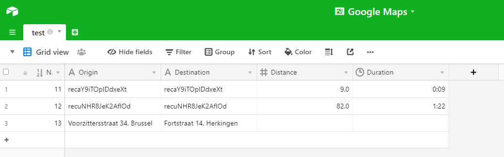
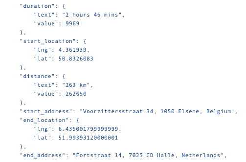
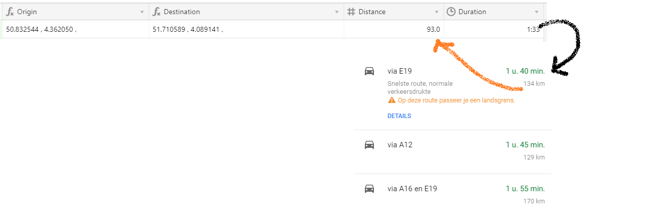
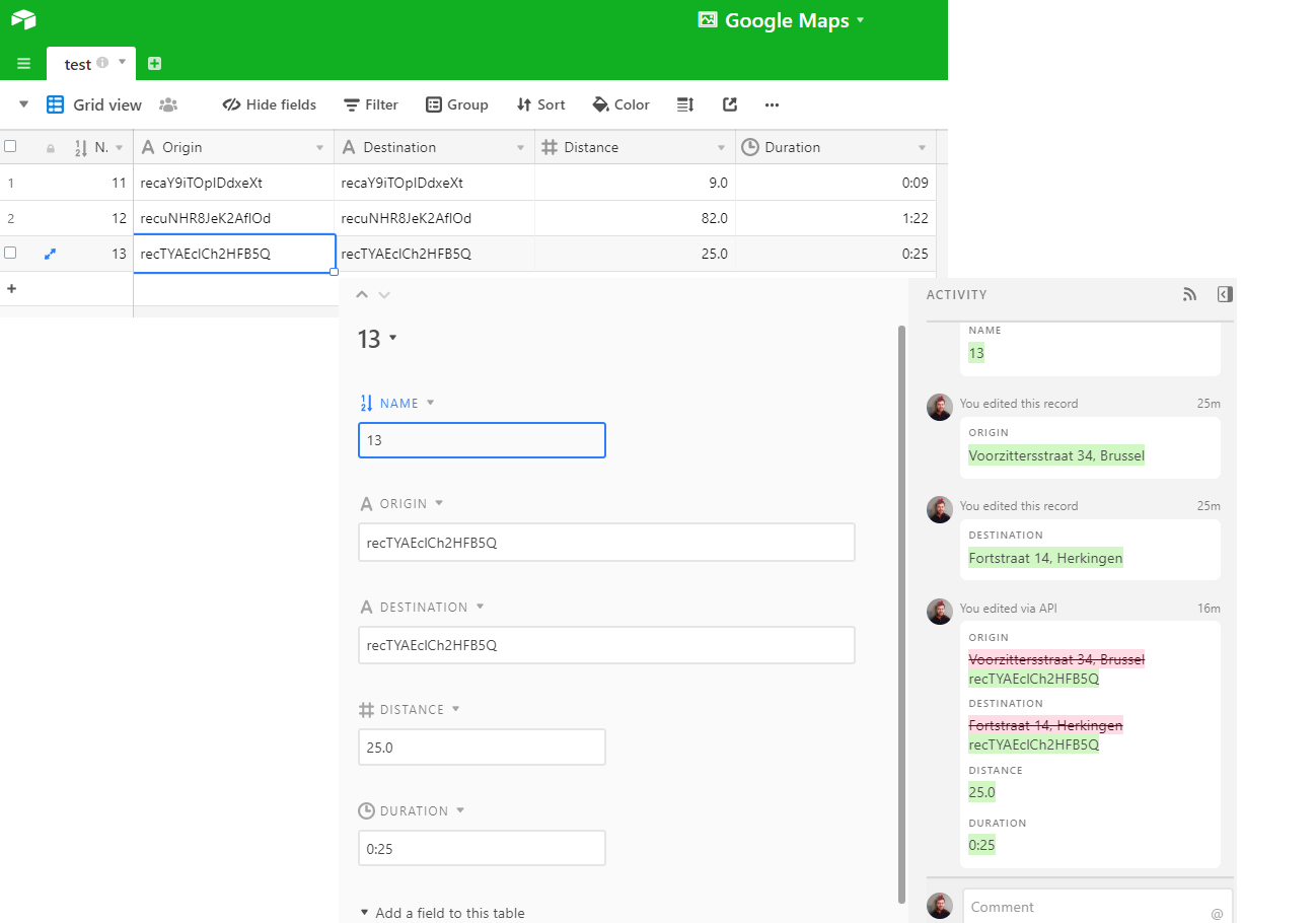 I came back to check and ‘it worked’, however the address are rewritten. That is a bit confusing. And there is something wrong with the distance and the timing (a small village in The Netherlands to Brussels in Belgium). Any the conclusion is that setting up a link between Google Maps and AirTable with Zapier works, but for the moment not as I had in mind.